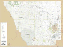
Larimer County Office of Emergency Management (OEM) Road Atlas

Page size: 11" x 17" (landscape)
Map scale vary depending on area of the county: 1:24,000 (1" = 2000'), 1:12,000 (1"=1000'), 1:6,000 (1"=500')
This comprehensive road atlas covers all 2,600 square miles of Larimer County at the 1:24,000 scale level. More densely populated areas also get coverage at 1:12,000 and 1:6,000 as needed. The atlas also comes with cover index page as well as map page index for road names, streams, lakes, schools, etc.
You can download the entire book or download the parts you need. Please keep in mind that the entire atlas pdf weighs in at 750 megabytes. Make sure you have a strong, fast internet connection.
Standard County Road Map
All of Larimer County Road Map
Map size: 36" x 48"
Map scale: 1:100,000 (1" = 8333')
This map displays major Larimer County highways and roads. This map does not label city street names, although it does show a single line for representation of most streets.
Detail County Road Map
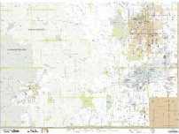
Four-map set (Northeast, Northwest, Southeast and Southwest quadrants), available for individual purchase
Map size: 36" x 48"
Map scale: 1:50,000 (1" = 4166')
These maps display Larimer County roads. This map does not label city street names, although it does show a single line for representation of most streets.
Commissioner Districts/Voter Precincts
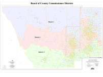
Board of County Commissioner District Map
Map size: 36" x 48"
Map scale: 1" = 1 mile
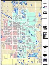
Development Activity Map
This product is no longer available. For Development activity information please see the Pending Case Map.
County Zoning Map (2 map sizes)
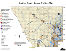
Larimer County Planning Department
Two versions of the County Zoning Map are available.
New zoning regulation changes effective March 31, 2021
All Larimer County
Map size: 36" x 48"
Map scale: 1" = 2 miles
Front Range only
Map size: 36" x 33"
Map scale: 1" = 50,000 feet
Voter Precinct Maps
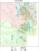
Election Maps: Congressional, House & Senate Districts
Each Election District includes labeled precinct numbers
Map size: 36" x 48"
House District #49 and Senate District #15 entire Larimer County.
The remaining House Districts and Senate Districts show the detailed district only.
